

 Facebook
 X
X
 Pinterest
 Copy Link
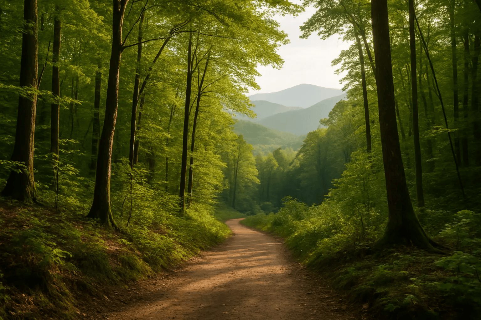
For many folks, Gatlinburg, Tennessee is synonymous with pancake houses, family vacation photos, and a neon-lit Parkway bustling with traffic. But the city is also the gateway to hikes that redefine what it means to step into nature. Think misty mountain trails, waterfalls hidden in lush forests, and ridge lines with panoramic views of the Smokies. If you’ve had enough of the tourist strip and want to trade carnival noise for chirping birds, this guide is for you. Below are the six best hikes in Gatlinburg, complete with tips to aid you if you’ve never hiked there before. Lace up your boots and let’s dive in.
1. Alum Cave Trail: Early Birds Get the Best Views
Overview
Alum Cave Trail is often showcased in brochures, but don’t let the popularity fool you—it’s a majestic route worth your time. The entire trail (out-and-back) is about 4.4 miles if you only go to Alum Cave Bluffs, or closer to 10 miles if you continue all the way to Mount LeConte’s summit. Early risers tend to have the best experience: fewer crowds, cooler temps, and a better chance of seeing wildlife (like the occasional black bear roaming deeper in the woods).
Why This Hike Stands Out
- Progressive Scenery: The path starts along a gentle river, then you reach landmarks like Arch Rock, followed by the striking Alum Cave Bluffs, which aren’t caves in the literal sense but a dramatic overhang.
- Optional Summit: Many hikers press on to Mount LeConte for a top-of-the-world view. If you have the stamina, that extra push is worth it.
Tips
- Go Early to Dodge Crowds: Parking can get wild by mid-morning. Aim to arrive by 7 or 8 AM, especially in peak season.
- Watch for Icy Conditions: In cooler months or early spring, parts of the trail can turn slippery, especially near Arch Rock’s stone steps. Carry traction devices if you’re tackling it in winter or during a cold snap.
- Pack Enough Water: It’s easy to underestimate how thirsty you’ll get in the Smokies’ humidity. Refilling is not straightforward on this route unless you carry a filtration system.
2. Chimney Tops: Short but Steep, and an Adrenaline Rush at the End
Overview
Chimney Tops is renowned for being relatively short (around 4 miles round trip) but with a final stretch that will make your legs quake. The original summit scramble was closed after the 2016 wildfires, but a rerouted final segment offers a vantage point that’s jaw-dropping without as much risk. Still, it’s a steep trek, gaining more than 1,400 feet in under 2 miles.
Why This Hike Stands Out
- Physical Challenge: For a short distance, you get a serious workout. If you’re short on time but want a heart-pounding ascent and a scenic payoff, this is your spot.
- Incredible Overlook: The platform near the top lets you soak in the Smokies’ layered ridges. On a clear day, you’ll see far into the distance (rolling peaks and valleys that seem endless).
Tips
- Trek Poles for the Descent: Some find trekking poles overkill on short hikes, but descending a steep path can punish your knees. Poles help, especially if the trail is damp.
- Weekday Afternoons: Mornings and weekends are packed. A weekday afternoon can feel a tad quieter, though afternoons can also bring pop-up storms in summer.
- Respect the Restoration Areas: Post-wildfire, certain spots are fragile with new growth. Stick to the designated path and keep an eye on signage to avoid damaging the recovering ecosystem.
3. Grotto Falls on Trillium Gap Trail: A Family-Friendly Waterfall Stroll
Overview
For those craving a more relaxed excursion, Grotto Falls fits the bill. The entire round trip is about 2.6 miles, with moderate elevation gain. The trailhead is along the Roaring Fork Motor Nature Trail, a scenic drive in its own right. Grotto Falls is famous because you can actually walk behind the waterfall, making for memorable photos and a refreshing cool-down spot in warmer months.
Why This Hike Stands Out
- Behind-the-Falls Experience: Not every waterfall in the Smokies lets you meander behind the curtain of water. Here, you’ll literally feel the mist on your face.
- Wildlife Potential: Keep your eyes peeled for salamanders near the wet rocks or black bears foraging (especially in the early morning or late evening).
Tips
- Parking Logistics: Roaring Fork Motor Nature Trail can be closed in winter and is often jammed in peak tourist season. Arrive early or later in the day to secure a spot.
- Gentle Enough for Most: Families with kids or older adults in decent shape can handle this. Just note that the terrain can get muddy, so footwear with good grip is essential.
- Keep an Eye on Trail Junctions: The Trillium Gap Trail continues beyond Grotto Falls to Mount LeConte. If you’re only aiming for the waterfall, pay attention to signage so you don’t wander off on a longer trek than planned.
4. Ramsey Cascades: The Tallest Waterfall in the Park
Overview
Ready to go big? Ramsey Cascades is the highest waterfall in the national park, and the out-and-back trek is about 8 miles total. This journey is more challenging, climbing over 2,000 feet in elevation. The last stretch includes boulder hopping, so expect to use your hands a bit. The payoff is a magnificent multi-tiered waterfall, with the final tier plunging around 100 feet.
Why This Hike Stands Out
- Serene Old-Growth Forest: Early on, you’ll pass through sections of old-growth trees. Some are massive poplars, reminiscent of the Smokies before logging reshaped the region.
- Less Crowded: Because it’s longer and more strenuous, fewer casual tourists tackle this path. You might find segments of the trail all to yourself, especially on weekdays.
Tips
- Plan for an Entire Morning or Afternoon: At 8 miles, plus the drive out to the Greenbrier area, this isn’t a quick jaunt. Factor in breaks, photography, and possibly a picnic near the falls.
- Mind the Boulder Section: The approach to the waterfall involves climbing over slippery rocks. Keep your footing and go slow. If it’s rained recently, the stones can be treacherous.
- Don’t Climb the Falls: Several tragic accidents have occurred here from people trying to scramble up the slick rocks at the waterfall’s base. The signs might seem repetitive, but they’re there for good reason.
5. Laurel Falls: A Paved Path with Big Rewards
Overview
Laurel Falls is probably the most visited waterfall trail in the park, thanks to a paved walkway and a relatively short 2.6-mile round trip. The waterfall itself is a picturesque, multi-tiered cascade that flows into a small pool. This route is child-friendly, though the pavement is old and can be uneven in spots.
Why This Hike Stands Out
- Easy Access: If you’re not a seasoned hiker or you’ve got limited mobility, this is a friendlier option. It’s not fully wheelchair-accessible due to wear and tear, but the paved surface helps reduce tripping hazards.
- Classic Photo Op: The upper and lower sections of Laurel Falls are both photogenic. Expect crowds brandishing cameras during almost any daylight hour.
Tips
- Arrive Early or Go Late: The parking area along Little River Road overflows quickly, so aim for off-peak times.
- Stay on the Trail: The edges near the waterfall can be slippery. Resist the urge to hop across rocks or explore side slopes.
- Keep an Eye on Kids: Although the trail is paved, certain sections have steep drop-offs. Supervise children closely, especially near the waterfall’s edge.
6. The Boulevard Trail (Mount LeConte Alternate): A Longer, Less-Traveled Path
Overview
While most folks ascend Mount LeConte via Alum Cave, The Boulevard Trail offers an alternate route with fewer people and extended ridgeline views. The trail typically starts from the Appalachian Trail at Newfound Gap, linking up with The Boulevard before reaching LeConte’s summit. Expect a 14-15 mile round trip, depending on your exact starting point.
Why This Hike Stands Out
- Sweeping Ridges: The path skirts along high ridges, granting vantage points across the Smokies that most day hikers miss.
- Fewer Crowds: Because it’s longer and more complicated to access, you won’t see the heavy foot traffic that clogs the Alum Cave route.
- A Glimpse of the AT: You’ll briefly tread the iconic Appalachian Trail near Newfound Gap, which adds an extra layer of excitement if you’ve dreamed of this legendary footpath.
Tips
- Check Weather Reports: At these higher elevations, conditions can shift suddenly. A mild day in Gatlinburg can turn into chilly winds or fog on the ridge.
- Carry Layers: Even in summer, breezes at 5,000+ feet can drop temps, especially on exposed ridges. A light jacket or windbreaker is smart.
- Consider a Shuttle: If you want to avoid backtracking, coordinate with a friend or local shuttle service. But plan carefully—this isn’t the most straightforward route to arrange.
Extra Pointers for Hiking Around Gatlinburg
1. Parking Realities
Great Smoky Mountains National Park introduced a parking tag system for certain lots. If you haven’t heard, you might be surprised at the trailhead if a ranger asks about your tag. It’s generally inexpensive and helps maintain trails. But definitely buy a tag online or at a visitor center before you park.
2. Bear Safety
Black bears roam these forests, so keep your food tucked away and don’t try to grab a selfie with a cub. If you encounter one, speak calmly, make yourself look bigger, and back away slowly. Never run—that can trigger a chase instinct.
3. Weather Swings
Don’t underestimate how fast conditions can change. Gatlinburg might be warm, but a higher-elevation trail could have swirling fog and a 20-degree temperature drop. Always stash an extra layer and a rain jacket in your pack.
4. Leave No Trace
With tens of millions visiting the park annually, each individual’s impact adds up. Pack out any trash, stay on designated trails, and respect wildlife. Your good habits help preserve these areas for future visitors.
Planning for Each Season
- Spring: Blooming wildflowers along trails like Porters Creek or Chestnut Top can be spectacular. Watch for muddy paths after rain.
- Summer: Expect crowds and humid conditions. Early mornings or weekday afternoons reduce the congestion.
- Fall: Leaf-peeping mania hits full force in October. If you want a perfect snapshot of autumn foliage, plan your route and start time meticulously; parking lots fill up before dawn.
- Winter: Some roads (like Roaring Fork Motor Nature Trail) close. Check the park’s Twitter feed or website for updates. Trails at higher elevations might have icy patches, so traction devices can be a lifesaver.
The Real Takeaway
Gatlinburg’s touristy reputation might overshadow the fact that you’re on the doorstep of incredible wilderness. From a short stroll behind a waterfall to an all-day trek over ridges, there’s a trail for every fitness level. The main challenge is choosing your route—and dodging peak tourist traffic. Plan well, respect the park’s guidelines, and keep an eye out for those steep drop-offs or icy rocks. With the right preparation, you’ll discover that these mountain paths deliver an experience more memorable than any pancake breakfast or souvenir shop. Whether you’re a beginner testing out your first day hike or a seasoned trekker craving a strenuous climb, Gatlinburg’s backcountry has what you need.
So next time you find yourself stuck behind a slow-moving car downtown, cursing the traffic, remember: you’re only a short drive away from some of the most captivating trails in the Smokies. Pack your gear, arrive early, and let the natural world remind you why this corner of Tennessee is so much more than its neon lights. Keep your feet on the path, your eyes on the ridges, and you’ll leave with stories (and photos) worth telling long


